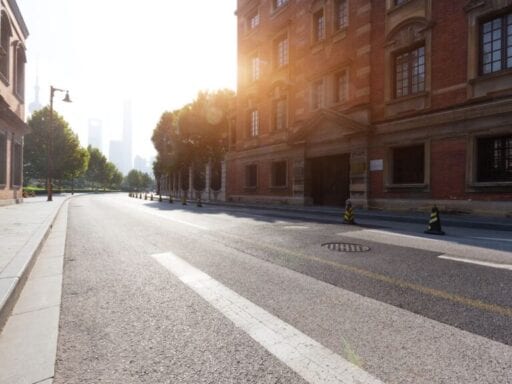
San Francisco and New York City are limiting cars on certain streets to prioritize other modes of transit.
In her 1961 book The Death and Life of Great American Cities, urbanist writer Jane Jacobs posed a prescient concern. She forecasted one of two possible outcomes for our urban future: “erosion of cities by automobiles, or attrition of automobiles by cities.”
To put it simply, Jacobs declared that if cars (and the highways and streets they run on) were left unchecked, the nature of the city would be gradually stripped away. She predicted that sprawl would make streets unwalkable, detaching neighborhoods and public spaces from one another. It sounded all doom and gloom, unless cities could impede that growth by limiting cars and reduce their influence on the streets.
The problem isn’t cars themselves, she argued, but the cumulative effect of an urban planning system that prioritizes cars over other modes of transportation. “The point of cities is multiplicity of choice,” Jacobs wrote. “It is impossible to take advantage of multiplicity of choice without being able to get around easily.”
Cities across the US and the world are experimenting with the “attrition of automobiles” by closing certain streets and areas to cars. San Francisco recently approved a $600-million plan to remove private vehicles from its busy Market Street, which will be renovated into space for street cars, buses, cyclists, and pedestrians. (Taxis, as well as Uber and Lyft vehicles, are still allowed and will have specific loading zones.)
In October, New York City turned a one-mile stretch of 14th Street into a busway, banning all cars except some trucks and emergency vehicles. European cities like Barcelona, Madrid, and Oslo have established car-free zones in downtown centers, and these initiatives can prompt backlash but are often strongly supported by residents.
Citizens enjoy having a variety of options to fulfill their transportation needs, and cities are realizing that. In the past, before vehicles like electric scooters or city bikes were widely available, people were limited to cars, buses, or the subway. With more diverse transit options, cities are forced to plan for improved safety and access, to build streets that accommodate all types of transportation. And that means scaling back on what they’ve built themselves around for decades: the car.
The micro-mobility revolution has encouraged cities to reassess their transportation needs
The idea of a car-reduced city isn’t entirely new; cities have looked to close streets to vehicular traffic and create pedestrian corridors for decades. But what is new is the surge in micro-mobility options afforded to people, which have pushed cities to reassess how to organize their streets. The impending threat of climate change has also added pressure on local officials to cut back on carbon emissions. (Transportation is one of the top producers of carbon emissions for the US.)
These small, often electric vehicles — shareable bicycles, scooters, and mopeds — have popped up on city streets in recent years. Dockless scooters appear in cities overnight seemingly without warning, from companies like Spin, Bird, Lime, and Skip; ride-sharing giants Uber and Lyft also invested in dockless bikes.
/cdn.vox-cdn.com/uploads/chorus_asset/file/19319356/1167818367.jpg.jpg) John Macdougall/AFP/Getty Images
John Macdougall/AFP/Getty ImagesTheir sudden arrival has caused confusion and even anger (mainly with the scooters) among residents and the local politicians tasked with regulating them. Some cities have required their swift removal, while others have more openly embraced scooters and started crafting laws for their usage. And whether scooters are actually environmentally sound is questionable.
But one thing is certain: Residents find these vehicles convenient, and they influence how people travel short distances — closing the gap left by cars, buses, and trains as a more direct means of transportation. Certain areas in cities, particularly low-income communities, are located far from transit hubs or lack direct bus or subway routes. Micro-mobility is a cheap, accessible option that could benefit communities previously overlooked by urban planners.
“Perhaps one of the greatest benefits of scooters will be that they will force a larger discussion of whom or what we prioritize when we design cities,” wrote Vox’s Umair Irfan.
That’s a philosophical approach some cities are taking, but it’s also being played out like a turf war, says Uwe Brandes, director of the Global Cities Initiative at Georgetown University: “How much territory in the public realm should be allocated to individual modes?”
In other words, how much should we be prioritizing cars when so many other alternatives are available and being widely used? The “multiplicity of choice” in cities, as Jacobs described, has suddenly gotten more complicated. While many of these new mobility options take up much less room than cars, they’re fighting to co-exist on streets that are designed for cars.
Then there are other questions, like whether sidewalks should be expanded to make way for charging stations. Should there be more street space dedicated for electric vehicles? Should there be separate pedestrian corridors, keeping everything with wheels lumped together on the road?
These are questions cities are tasked with figuring out, Brandes says. The problem is that there’s really no perfect model for a city to follow; each has to rely on its own infrastructure capacity and land use densities to determine what’s best for its streets, he explains.
Most streets in the US aren’t designed for pedestrians or cyclists. That’s a safety hazard.
Smart street planning and regulations to enforce safe driving are also crucial for safety. In recent years, pedestrian and cyclist deaths have risen in the US, even as the total number of traffic deaths decreased. About 17 pedestrians and two cyclists were killed on average each day in 2018 — the highest since 1990, according to a report by the National Highway Traffic Safety Administration.
Factors like distracted driving and speeding contribute to an increase in fatalities, and according to the Advocates for Highway and Auto Safety, few states have strict safety laws to prevent accidents.
/cdn.vox-cdn.com/uploads/chorus_asset/file/19319382/GettyImages_564098445.jpg) Getty Images
Getty ImagesAmerican streets are also dangerous by design; they’re typically in sprawling metro areas with fast multi-lane highways that aren’t pedestrian-friendly. Cities have adopted “vision zero” initiatives to reduce traffic deaths by installing crosswalks, bike lanes, and slowing down road speeds, but it still isn’t safe.
San Francisco’s project aims to turn one of its busiest, most chaotic streets into a multi-use space for all residents — no matter how they choose to commute. Market Street’s infrastructure hasn’t been rebuilt in 45 years, but one in 10 San Francisco transit riders are on the street every day, alongside thousands of bicycle commuters and drivers.
Most traffic collisions that occur on Market Street annually affect pedestrians or bicyclists, according to the San Francisco Examiner.
The city plans to shrink the street in favor of a widened sidewalk and eight-feet-wide bike lane, which will be shared by bikes and electric scooters. Streetcars will still run through its center, while buses and other ride-sharing vehicles will run on both sides of the smaller road.
The plan passed the San Francisco’s transportation agency board with no opposition, although bureaucratic delays have pushed it back by nearly a decade, the Examiner reported. It even received endorsements from Lyft and Uber, whose drivers won’t be banned from the road but will have separate loading areas. The first stage of construction on Market Street will start in 2020.
“Closing Market Street to cars has been discussed on and off for decades,” says Elizabeth Deakin, a professor of city and regional planning at UC Berkeley. “I can remember that it was first brought up in the 1970s.”
Change can happen slowly, as citizens and public officials warm up to ideas that once seemed far from the mainstream. CityLab pointed out how advocacy groups have led the years-long push for safer streets in San Francisco, and other cities’ car-free zones have prompted officials to act.
Car-free zones can reduce congestion — under the right circumstances
With its $600-million price tag, San Francisco’s plan is a radical version of what many cities are experimenting with, like New York. The 14th Street busway plan was initially intended to mitigate the shutdown of the L train in Manhattan (a train line that connects two New York boroughs for around 250,000 daily riders) by improving bus routes on the major crosstown path. The city originally planned to shut down the line for a 15-month repair period, and run 80 buses every hour to accommodate riders; that plan was not implemented.
Although the L train is still in service, the busway plan was approved in late September, after it was stalled twice in court by residents and business owners. Unlike San Francisco, the busway is off-limits to virtually all cars for roughly a mile stretch, including taxis and ride-sharing vehicles.
/cdn.vox-cdn.com/uploads/chorus_asset/file/19319418/1089479698.jpg.jpg) Spencer Platt/Getty Images
Spencer Platt/Getty ImagesLess than a quarter of Manhattan’s residents own cars, but that statistic doesn’t account for people who commute into the city by car, or those who hail cars to get around. Ride-sharing services have prompted a surge of car usage, and New Yorkers are increasingly relying on Lyft or Uber rather than the subway or bus. So while people aren’t necessarily owning more cars, they’re still adding to the daily congestion.
Furthermore, “New York is a place where we have no alleys on our major streets, so everything — from deliveries to customers — are coming in or out from the front,” says Mitchell Moss, director of New York University’s Rudin Center for Transportation Policy and Management.
That puts an immense burden on city streets, he explains, especially for a crowded artery like 14th Street. Trucks and large delivery vehicles also contribute to the growing congestion problem by driving in residential areas.
Instead of falling into a cycle of induced demand — building more roads and highways, which tends to bring more traffic — banning cars from certain areas is a “fairly reversible policy,” Deakin adds. It just requires regulation, which isn’t expensive, and the policy can be tweaked if a city wants to change its car restrictions.
According to local officials, 14th Street turned out to be a “miracle.” Recent data by the research firm INRIX has shown that traffic levels in nearby areas have hardly changed, although the long-term effects of the project haven’t been determined yet. (As Jacobs observed, when streets are closed for pedestrian use, traffic is typically diverted into other areas. That rearrangement of traffic wouldn’t have solved the larger issue, which is to reduce car use overall.)
The experiment’s successful short-term effects — increasing bus speeds and not causing side-street congestion — have prompted local officials to encourage adding car-free zones to other major streets.
Car-free zones can fail if they don’t generate enough foot traffic in the area. The city of Buffalo, New York, planned to create a pedestrian mall in the 1980s by closing its Main Street to cars and building a light-rail system that would run through its center. That plan failed, Brandes says, because not enough people were drawn to the area to keep businesses alive.
Those same business concerns were echoed by some Manhattan business owners on 14th Street, who believe it’s a major artery that brings customers to their front doors by car. Compared to Buffalo, though, pedestrian activity in Manhattan is much more lively.
Future cities won’t be without cars. There likely just won’t be as many.
The plan for cities like San Francisco or New York isn’t to get rid of cars, it’s to wean the focus from them towards more inclusive spaces. “The car is not the enemy of urban life,” Moss says. “We have to think about having multiple ways of moving people.”
In Barcelona, portions of the city are configured into walkable, mixed-use public spaces called “superblocks.” As Vox’s David Roberts reported, it’s a utopian vision that hasn’t been achieved yet by an existing major city. It’s similar to what Jacobs envisioned, which is reducing the prevalence of cars, the amount of space they occupy, and demand for their services.
While no American cities have such a sweeping transportation reform plan in place as Barcelona’s, car-free streets are a start. And as new micro-mobility options become available in more metropolitan areas, that encourages cities to push the envelope of what they’re comfortable experimenting with.
Still, the longer cities wait to act, the longer citizens will be stuck in a cycle of seemingly endless traffic congestion.
“If we continue with the status quo, we can’t produce sustainable communities,” Brandes says. “This is the first generation of experiments, and it’s exciting to see us embrace the sharing economy.”
Sign up for The Goods’ newsletter. Twice a week, we’ll send you the best Goods stories exploring what we buy, why we buy it, and why it matters.
Author: Terry Nguyen
Read More


