Every year, climate change makes a “catastrophic” fire like this one more and more likely.
This is part two in a three-part series about worst-case extreme weather scenarios in three regions of the United States — Arizona, California, and Florida — that are particularly vulnerable to the effects of climate change. In this story, we’ll consider a Big One that could ravage Southern California: a truly gargantuan wildfire that’s within the realm of possibility.
The wildfire that smashes all of California’s previous notions of “the worst that could happen” begins with an illegal firecracker set off by campers in the the San Bernardino National Forest. Patches of this forest, near the spa city of Palm Springs, have burned many times before. But this fire becomes monstrously big in a matter of hours because a severe, multi-year drought and an extra-long hot summer have left an unprecedented number of trees and shrubs bone dry, defenseless to flame.
As tall Ponderosa and sugar pine trees in the federally protected area are engulfed, embers from their crowns fly forward, propelled by wind, igniting the next patch of forest. US Forest Service firefighters try to contain it, but the fire is too big and moving much too fast with fierce winds helping it along. In just two days, the fire is 10 miles wide.
The fire can spread in all directions inside the national forest with so much available fuel, and at first there isn’t much threat to human life. But as it grows bigger, it will race eastward toward the edge of Palm Springs, population 48,000, and northeast toward San Bernardino, population 220,000.
/cdn.vox-cdn.com/uploads/chorus_asset/file/19139478/SoCal_Fire_map_20190830.png) Ryan Mark
Ryan MarkIn some directions, the fire will hit bare rocky hills and sputter out. But in other directions, the trees and shrubs turn abruptly to tract housing, mobile homes, and unattached homes. Here, the embers will blow onto roofs, onto parched lawns and bushes, and begin burning thousands of buildings, block by block.
Some residents have evacuated in time, but others die in their cars or their homes as the flames overtake them. The fire’s girth and speed will overwhelm the capacities of Palm Springs’s and San Bernardino’s fire departments to put it out until reinforcements are sent in. Small towns also in its path, like Anza and Hemet, have even fewer resources to fight it.
Smoke from the growing blazes begins carrying 100 miles west into Los Angeles and 100 miles south to San Diego, leading to hazardous air quality throughout Southern California. Thousands of children and elderly are rushed to the hospital with asthma attacks and respiratory illness. Some with heart and lung disease die. Hundreds of schools close, and officials tell 10 million Southern Californians now living under a massive smoke cloud to stay indoors with their windows and doors closed. This smoke hazard will last for two-and-a-half weeks as the fire burns and the smoke lingers.
In its second week, the fire will grow wider as it finds abundant new fuel to the south in the Cleveland National Forest and the Anza-Borrego Desert State Park in San Diego County. At its widest, it will be 60 miles across. It now will have burned through several different ecosystems: coastal sage scrub, chaparral, oaks, and conifer trees, all of them parched by drought and hot air. It will leap into the town of Temecula, population 114,000, and Oceanside, population 176,000.
In all it will burn over 1.5 million acres, an area the size of Delaware and more than three times the size of the Mendocino Complex fire of 2018, the largest wildfire in state history. It could destroy 100,000 buildings and take hundreds of lives. And if it happens in the coming years, human-induced warming will undoubtedly be a factor.
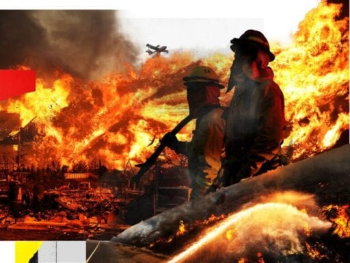
/cdn.vox-cdn.com/uploads/chorus_asset/file/19180928/GettyImages_591628104.jpg) David McNew/Getty Images
David McNew/Getty ImagesSouthern California is susceptible to a horrifically gigantic fire disaster like this
This nightmare fire is hypothetical, created by a wildfire simulator, a computer model called FSim. Scientists use FSim to figure out extreme scenarios the environment is capable of, using data on historical weather patterns, available fuel on public and private lands, and several other variables.
It doesn’t predict specific wildfire events — that would be impossible, since every wildfire begins with an unpredictable ignition, or spark — but it imagines new fire seasons by recombining what has happened in the past. And every scenario it spits out is within the physical bounds of the possible.
Alan Ager, a researcher at the US Forest Service who studies how to manage wildfire risk on federally managed forests and other lands, found the 1.5 million-acre fire simulation in a database of simulated fires at the Missoula Fire Lab after I asked about the largest possible fire that could hit Southern California. I chose the region because it’s the most densely populated part of the state with very high wildfire hazard, according to the California Department of Forestry and Fire Protection, or Cal Fire.
FSim estimated that this fire would destroy 82,000 buildings. But Ager said the structural toll would actually be much higher, since the simulator only models the spread of fire into wildlands and calculates the lost buildings on that land.
The simulation, however, clearly shows that the flames could spread to the edges of several towns and cities, including Anza, Palm Springs, and Temecula, where hundreds of thousands of people live.
“There’s tons of fuel for wildfires in the houses,” Ager said. “Once the fire is at the edge it can ignite other houses.” Homes built before 2008 are at particular risk of burning, according to a recent investigation by several California newspapers and the Associated Press.
/cdn.vox-cdn.com/uploads/chorus_asset/file/19181339/GettyImages_989241534.jpg) Josh Edelson/AFP/Getty Images
Josh Edelson/AFP/Getty ImagesThe model doesn’t estimate a death toll, but Ager said you can imagine a fire of this magnitude could be catastrophic given the 86 deaths in Paradise in the 2018 Camp Fire, a fire one tenth of the size.
David Sapsis, a wildland fire scientist with Cal Fire who reviewed the simulation, agreed. “The damage would likely be massive, potentially dwarfing what we have seen recently.”
And it’s a scenario that becomes more likely in the near future given what scientists know about how climate change will increase wildfire risk in California.
Climate models show that as temperatures continue to rise, the atmosphere and land in some regions, like California’s forests, will grow more arid. This in turn will make shrubs and trees drier and more flammable.
“Climate change is amplifying fire behavior and fire size,” Ager said. Which means a worst-case scenario fire like the one described above could be even worse in the future.
“The same places in California that have had historic fires are likely to be in worse conditions in an additional 30 years,” said Chris Keithley, research manager for the Fire and Resource Assessment Program at Cal Fire. “Climate change is going to increase the overall risk potential.”
Why should we contemplate this horror? Because elevated fire weather conditions are expected in the region this week. And because we’ve seen just in the last two years how communities in California living in high and very high fire hazard severity zones can be caught off guard and suffer horrendous effects as climate change exacerbates the conditions that create a monster fire.
California’s 2018 wildfire season was one for the history books, with 10 large fires that burned more than 500 acres apiece. Most infamous was the Camp Fire, which left 86 dead in Paradise, and caused more than $16.5 billion in losses, according to the German insurance company Munich RE. The Woolsey Fire left a big scar as well, killing three and destroying a range of homes, including some of the most expensive real estate in Malibu and Calabasas: the homes of Miley Cyrus, Daryl Hannah, and Kim Basinger, among others.
/cdn.vox-cdn.com/uploads/chorus_asset/file/19181522/GettyImages_1059684446.jpg) Josh Edelson/AFP/Getty Images
Josh Edelson/AFP/Getty Images/cdn.vox-cdn.com/uploads/chorus_asset/file/19181557/GettyImages_1059714872.jpg) Robyn Beck/AFP/Getty Images
Robyn Beck/AFP/Getty Images2018 showed California why it needs to dramatically both limit the threat (by cutting emissions and better managing flammable forests) and prepare for disaster.
“I don’t know that people have taken to heart that wildfires are worse and worse in part because of climate change and not getting better anytime soon,” said John Abatzoglou, a scientist at the University of Idaho who looks at the impacts of climate change on wildfire. “I’m not sure we’ve calibrated. Californians may need to learn to think about future fires as the Big One, like an earthquake.”
So in the spirit of facing down the risks, let’s explore a little further what may be in store for California as the climate changes and consider a few key ways it can respond.
Why California can expect wildfire season to get worse
California’s forests and shrublands have been subjected to wildfire pretty much forever; fire is a natural part of many of the state’s ecosystems. What’s different now is that the season is getting longer and the fires are on average getting bigger and more destructive.
The basic recipe for a monster, 21st-century wildfire is this: Take hot air and no rain and moisture evaporating from trees, shrubs, and soil. After a series of long, expansive, hot, dry spells, trees and shrubs will be transformed into ideal tinder to feed a fire. The bigger the area affected, the more available fuel. All you need then is a spark, which could come from a power line failure, a cigarette, or a firecracker.
/cdn.vox-cdn.com/uploads/chorus_asset/file/19182271/all_regions_wildfires_80.jpg) Christina Animashaun/Vox
Christina Animashaun/Vox“Fire can travel larger distances [than in the past because there’s more fuel] to get to communities,” Ager said. “Meanwhile communities are expanding. Every time someone builds another house, the risk increases.”
Many other states in the west, including Oregon and Colorado, are likely to see larger, more devastating fires as the climate heats up. But California is at particular risk, both because it may see more droughts than other states and because it has more people and more buildings.
A recent study by Ager and colleagues found that 1,812 communities in the western US could be significantly impacted by future wildfires. Of the top 20 most exposed communities on the list, 14 were in California. Several of the 14, including Anza and Temecula, are in the path of the simulated fire described above.
Some 11.3 million people — more than any other state with regular wildfires — live in what scientists call the “wildland-urban interface” in California. That’s 30 percent of the population living near a lot of potential wildfire fuel. And more than 2.7 million Californians currently live in “very high fire hazard severity zones,” areas where the population is expected to keep growing. (Cal Fire is currently updating its hazard zone maps and expects to roll out new ones by 2021.)
/cdn.vox-cdn.com/uploads/chorus_asset/file/19182274/south_coast_wildfire_80.jpg) Christina Animashaun/Vox
Christina Animashaun/VoxParts of Northern California and the Sierra Nevada can expect to see the most fire activity directly linked to human-caused climate change in the coming decades, according to a recent paper by Abatzoglou and colleagues.
But “you can throw a dart anywhere around Los Angeles and San Diego and you will hit an area with significant fire potential,” too, Keithley said.
And there’s a huge mismatch, Ager’s study found, between the increased wildfire threat and how cities are planning future development.
California and other wildfire-prone states still allow a lot of new construction in high-hazard fire zones. Local firefighters aren’t equipped to fight huge fires leaping from structure to structure. Just as it’s time to consider retreating from the coasts because of sea-level rise, it may be time to consider encouraging people to retreat from some of the riskiest areas.
/cdn.vox-cdn.com/uploads/chorus_asset/file/19181852/GettyImages_1061531286.jpg) David McNew/AFP/Getty Images
David McNew/AFP/Getty Images“I think planned retreat should be part of a suite of options,” said Paige Fischer, a social scientist who studies wildfires at the University of Michigan. So far, though, the state has done little to discourage new construction in high-risk areas or encourage people to move out of harm’s way.
But as Susan Gorin, a Sonoma County supervisor who lost her home in the Tubbs Fire that roared into Santa Rosa in October 2017, told Bloomberg, a reckoning may be coming:
“[W]e’ve pretty much given private-property owners the ability to build a house or a ranch just about anywhere that they own land. And yet the assumption for those private-property owners is that we will have the public fire resources to protect them in case of emergencies and wildfires. Property owners can’t make that assumption any longer. And our fire was a case in point … The fire came so hard, so fast, that no fire agency or agencies could have saved homes.”
In response to the billions of losses from the California wildfires of 2017 and 2018, insurance companies are now beginning to refuse to renew fire and homeowners liability insurance and hike rates for homeowners in fire-prone areas, the New York Times has reported.
But forcing people to move is an especially tough ask in California, which has a serious housing crisis. Many Paradise residents who lost their homes in the Camp Fire had moved there to escape the unaffordable rents and home prices of the Bay Area.
/cdn.vox-cdn.com/uploads/chorus_asset/file/19181900/GettyImages_1074626858.jpg) picture alliance via Getty Image
picture alliance via Getty ImageThe federal and state governments have increased funding for fire suppression and fuel management, according to Keithley of Cal Fire, but much more is needed. More prescribed burning could help limit fuels, but many communities oppose it because of the short-term smoke risk.
“Fuel management efforts need to be substantially increased,” Ager agreed. That responsibility falls largely to federal and state agencies like the Forest Service that manage public lands. People who live in high-risk areas can also do more to manage the land and structures on the private land around them, for instance reducing flammable vegetation around homes and using fire-repelling building materials, Fischer said.
Climate change demands both immediate action to reduce emissions and immediate threats and also long-term adaptation to a more hostile climate. California is a leader on the former — it has committed to 100 percent clean energy by 2045 and total, economy-wide carbon neutrality by 2045. And Gov. Gavin Newsom has also been trying to rally support for new funding from the state legislature to take on the threat of fire in a warming world.
/cdn.vox-cdn.com/uploads/chorus_asset/file/19182158/GettyImages_1066298472.jpg) Hans Gutknecht/Los Angeles Daily News via Getty Images
Hans Gutknecht/Los Angeles Daily News via Getty Images“Climate change has created a new reality in the State of California. It’s not a question of ‘if’ wildfire will strike, but ‘when,’” said Newsom in a June report. “Our recent, terrifying history bears that out.”
But he and other California leaders still have a long way to go in helping communities play better defense against wildfire. “We are overloaded with assessments and short on actions,” said Ager.
Author: Eliza Barclay
Read More